Length of ride: 8 Miles
Difficulty: Moderate with some Hike-a-bike
Suggested Skill Level: Intermediate
Trailhead longitude and latitude: 46 08 37N, 122 14 05W
Google Trail Head Location Google Trail Marker
 Google Directions From Portland
Description of Ride:
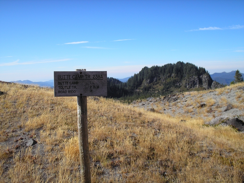
The ride starts at Red Rock pass on the Toutle trail #238.
At about 1-1/4 miles from Red Rock pass the Butte Camp trail #238A diverges from the main trail#238 and heads more northerly.
The ride to this point has been a moderate grade that I enjoyed very much.
The pitch in the incline increases and the ride becomes more technical. The path is mostly hard packed with lots of lava outcroppings and roots crossing the trail.
I take the climb in little sections, my goal is to ride and not hike. In the steeper sections I ride with my weight balanced between keeping the front tire on the ground and keeping enough weight on the rear tire so that I do not lose my grip.
I watch the trail intently; picking my way around and through the outcroppings, lose rubble, and roots. Looking for the next place where the grade is a little less and I can take a short break to catch my breath and lower my heart rate.
In reality there are only a few sections between the cutoff and the butte camp area that are that steep. Most of the time I just have to slow my pace to a crawl to maintain a consistent heart rate.
The climb is a low to mid-range climb.
On my trip there were at least 4 trees down across the path between the cut off and the butte camp area.
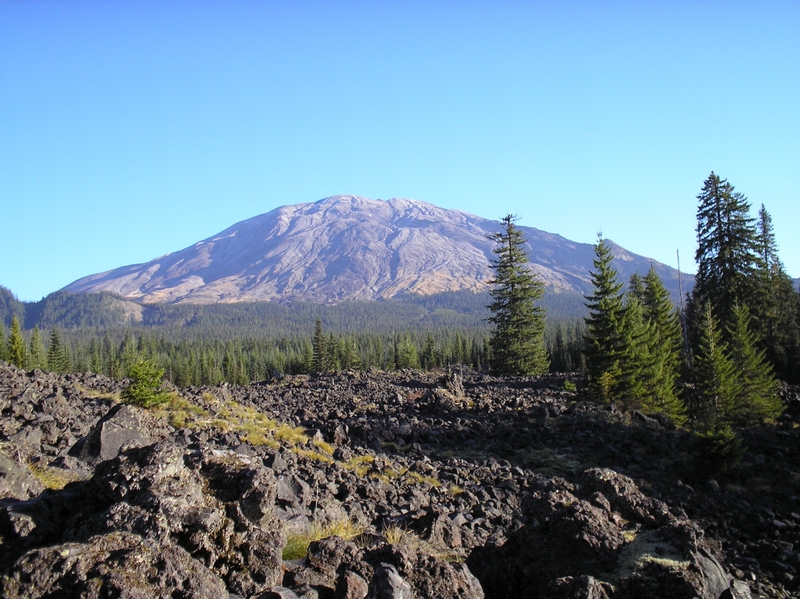
Upon arriving at the butte camp area, there is a large rock outcropping next to the trail. The jumble of rocks that form the outcropping covered in moss and packed together with ash, overlook a small valley.
The outcropping stands way above the tops of the trees in the valley below, Mt St Helens and the ridge that makes up the southeastern flank are visible to the northeast.
A short diversion from the trail, this is clearly an area that is visited by every hiker to pass by.
On returning to the trail it continues on through small trees and meadow area, the path itself raised a few inches above the surrounding landscape.
After a short stretch where I was able to shift up to my normal range of gears, the trail starts to climb again.
The trail leaves the meadow and makes a switchback on to the timber covered hillside. My pace slows back to what it was before.
The trail continues to climb and switchbacks up the hillside through tall, large timber. The tread alternating between hard pack and lose rock.
The rock that makes up a lot of the trail is small, coarse and gravelly in nature, hard to ride through. I take to walking my bike in many of these sections.
The slope of the hillside is quite extreme, which makes me cautious. I only ride in a few sections since a slight mistake could put me on a skid down through the trees.
There are three switchbacks before the trail turns to the north.
At this point the trail narrows up even more and I am forced to dismount and after a few feet, find there is not enough width to the trail for me to even walk my bike, so I have to carry it.
The trail breaks free from the timber here and crosses a rockslide. It is very narrow and exposed. I find myself forcing my focus to the trail because to look up makes my knees weak.
I have ridden this trail twice more with other riders that did not have the problem with the spatial effect that this section of the trail causes me.
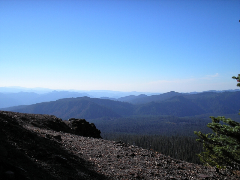
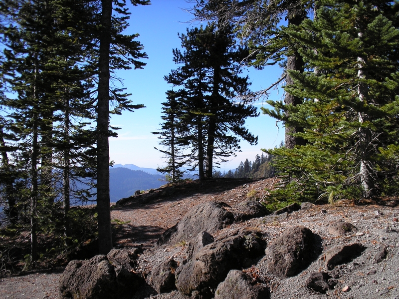
The route passes off of the rock slide and turns to cross the top of a cliff.
The view is awe-inspiring. The ridges and valleys stretched out before me fading into a blue haze.
As I look off to my right, I can see the trail crossing over the slide area, a thin line across the slope.
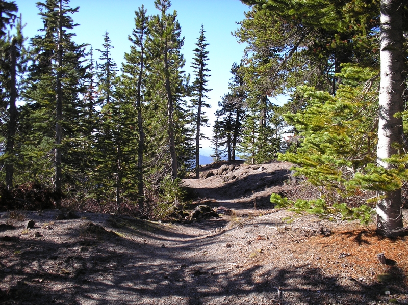
Turning back to the north I get back on my bike and start riding on the hard packed trail.
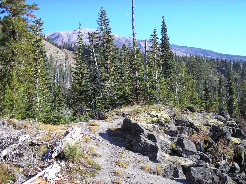
The area has changed into an alpine terrain. The trees here are stunted. The ground packed ash and lava rock. The kind of trail I like to ride, although there are not many I don't like to ride.
Mt St Helens barren and brown takes up the horizon, visible through the small trees that make up my surroundings.
A quarter mile further along the trail and the trees disappear.
The area is a brown meadow as the trail winds up onto a small lava ridge. Above the tree line now, I can look back over the trees at the butte I just circumvented and the valleys beyond.
Just a short distance further and there is a trail intersect with the Loowit trail 216.
I take a look at my map, thinking about the possibility of looping around onto trail 240. I am not excited about the prospect of crossing back over that slide area.
I soon come to the realization that the energy I have expended on the climb from 3,124 feet to my location now at 4,794 feet has taken its toll. Adding another 6 to 8 miles onto my trip is probably not the best idea, besides I only brought enough water for the planed excursion and my bottle is close to empty.
After a short break, looking over the breathtaking views I decide to head back down the trail.
Since the writing of this ride report, I have ridden from trail 240 to this location and it was a very good choice on my part not to try and make the connection. There is a huge and dangerous ravine that has to be crossed; it is not an excursion to be done alone.
It was a great ride back to the cliff.
The trail has plenty of slope and other then a few peddle strokes here and there I am coasting and breaking all the way back.
As I approach the cliff, through the trees, I feel angst and my heart rate starts to increase.
I took a few pictures, then picking up my bike; I started the transverse back across the slide.
About half way across, I stopped on a small wide spot. The spot had a small dead tree on the down slop side of me, and I was able to put my bike down. I had to kneel for a moment and focus on my racing heart.
After I felt back under control, I again picked up my bike and continued on across. I could hear voices far off.
After making the crossing, I rounded the shoulder of the butte and the trail widened out a bit.
A short ways down the trail and I hopped back on my bike, to scooter along the trail. With my fingertips touching the breaks and one foot pushing off on the hillside I rolled down the trail.
I would scooter along in sections where I felt a little unsure of myself, and planted both feet on the bike whenever the trail felt firm enough.
I always have a tendency on a narrow trail that has a steep side slope to steer too much toward the uphill side. I think it is only natural, but I have to keep focused on the trail and keeping my bike in the center, because when you ride too high on the trail, you only make the bike unstable.
The trail breaks into a small meadow area as it reaches the first switchback on the way down. When I re-enter the forest, I can see a party of people hiking up the trail.
Since trail etiquette dictates the hiker has the right of way, and I can use a short break, I stop in the first wide spot to let them pass.
There are 9 or 10 people in the party, and one dog. We exchange pleasantries as they pass, then I continue on down the trail.
A couple of more switchbacks and I am back to the butte camp area.
I have to say that I didn't care much for the ride in that half to three quarter mile, but it has to be done to enjoy the rest of the ride.
From here on the trail is moderately steep, with lots of challenges.
Like up on the top the trail is a lot of fun for me. Areas of lose rock and rubble, then stretches of lava rocks sticking up in the trail, making stair steps down the trail, with lots of roots.
The line takes me bumping down through each section, making swift smooth runs along the edge of the trail as it winds its way down through the woods.
I am careful to keep the right amount of pressure on both breaks and extra careful not to clamp down too hard on the front break as I bounce down over root and rock.
Stopping only long enough to dismount and lift my bike over downed trees, I reach the main Toutle trail in about 15 to 20 minutes.
Another 15 to 20 minutes and I am back to the lava field. Walking my bike across the sections of lose sharp lava, and riding as soon as I get to the filled in areas.
On another trip I tore a hole in the side wall of my tire while trying to ride through this section, a lava field.
The total ride was right at 8 miles, with about a half a mile of carrying my bike.
There were a lot of hikers this day, in total I came across 18 hikers, one party of 10, another of 5 then a couple and a single hiker.
